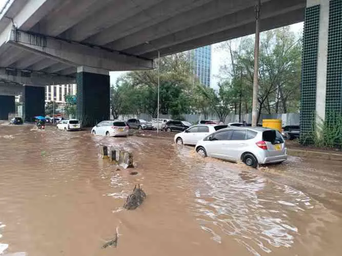
A mapping exercise conducted under the Nairobi Rivers Regeneration Programme has identified 37 neighbourhoods located along major river corridors and locations vulnerable to flooding.
In Nairobi East, the areas identified include Kiambiu, Dandora, Kariobangi, Kayole, Komarock, Njiru, Ruai, Mwiki, Donholm, Savannah, Tassia, and Fedha, many of which lie downstream along sections of the Nairobi River and its tributaries.
In Nairobi West, flood-prone locations include Madaraka, Nairobi West, Lang’ata, Kawangware, Kangemi, Lavington, Westlands, Parklands, Kitisuru, Spring Valley, Kileleshwa, and Chiromo, areas situated along upstream and midstream sections of the river network.
In the Nairobi North corridor, neighbourhoods such as Mathare, Korogocho, and Lucky Summer have been identified along the Mathare River, where dense settlements closely border the river banks.
Within Nairobi Central, key locations along the river corridor include the Central Business District (CBD), Globe, Gikomba, Eastleigh, and the Industrial Area, where sections of Nairobi River pass through.
In Nairobi South, the mapping highlights Kilimani, Kibera, South C, South B, Mukuru Kwa Reuben, and Kwa Njenga, many of which lie along the Ngong River corridor.
The Ministry of Interior and National Administration has asked residents living near riparian and low-lying areas to remain vigilant and prioritize their safety during periods of heavy rainfall.