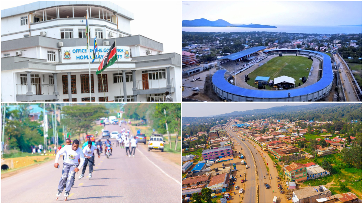
The 9th Devolution Conference kicks off Tuesday, August 12, with Homa Bay County hosting the week-long event meant to take stock of devolution in the country and chart a way forward.
Thought leaders, policymakers, practitioners, development partners, private sector, academia and mwananchi are expected to engage in meaningful discussions, a significant milestone in Kenya’s devolution journey, with the conference providing a platform for sharing experiences, best practices, and innovations in devolved governance.
But first, do you know how the county came to be known as ‘Homa Bay‘? What was the area referred to in the pre-colonial times? Who are the people inhabiting the county like? Where did they come from?
In this article, I will aspire to answer all these intriguing questions…
Homa Bay is known for its scenic hills and picturesque shoreline, covering an area of 3,183.3 sq km with a population of about 1.3 million people.
Before the colonial period, the area now called Homa Bay was originally known as Chich Onuno, meaning the Onunos market. If someone asked for directions in the early 1900s, locals would say, “Go towards Chich Onuno,” referencing the familiar area of trade in highlands near the lake.
In the Luo language, “chich” refers to “market” and “Onuno” is believed to be a personal or clan name tied to the local identity. The name Chich Onuno thus loosely meant “Onuno’s market”.
18th century: Luo migration
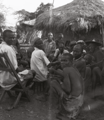
In the 18th century the area of present-day Homa Bay saw the first large-scale Luo migration down the Nile from eastern Uganda. Nilotic Luo-speaking clans crossed the Kavirondo (Winam) Gulf of Lake Victoria and established villages along its southern shore with the economy based on fishing, cattle herding and millet cultivation. Clans lived in fortified homesteads under clan elders and Ruoth (traditional chiefs).
The Suba people on Rusinga and Mfangano islands, on the other hand, are Bantu people of Baganda origin. The founder of the Wasuba people in Gwasi was a man known as Kiboye. He was a brother of a Kabaka in Uganda but fell out with his brother, Kabaka Jungu, and fled Uganda to Kenya through Lake Victoria where he carried his sister along and they settled in Gwasi.
Luo villages (pachos) introduced new crops such as sorghum, ground-nuts and simsim, supplementing traditional yams and millet. Social organization remained clan-based, with age-sets and clan councils governing daily life.
Trade and intermarriage with neighboring Bantu groups like the Luhya and Gusii spread new farming techniques. The Luos interacted with Bantu tribes, more specifically, a Kisii clan known as Mugirango, and referred to them as ‘la Mwah’.
At the turn of the 19th century, communities lived in clusters of home-steads with livestock enclosures, guided by elders. Spiritual life centered on ancestral belief systems and the people revered Nyasaye (the Supreme Being) and communicated with ancestors and spirit-mediums.
Clan chiefs managed local affairs, land and organized defenses, while community defenses were maintained by local warriors and Osumba commanders. There were modest long-distance trade contacts of salt and iron bartering with coastal caravans.
Luo communities in the Homa Bay region saw population growth. Maize and cassava were introduced via neighboring peoples and fishing supported larger villages. Cane sugar, tobacco and cotton were known to Luo traders through barter networks and with Lake Victoria to the north and dense forests to the south, the region remained on the periphery of the East African slave/ivory trade.
By the 1850s, some coastal goods like beads, cloth and iron hoes were exchanged for fish or cattle with passing caravans.
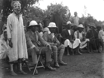
In the 1880s, the “Scramble for Africa” reached Kenya Britain and Germany negotiated influence. Small numbers of explorers and missionaries began to survey Nyanza Province. The Luo of South Nyanza (Kavirondo Gulf) were largely unaware of treaties signed in Europe. Politically, the clans maintained independence.
1890s: Chich Onuno
By the 1890s, formal colonial control began. In 1895 Britain declared the East Africa Protectorate, which encompassed the Kavirondo Gulf region. The Uganda Railway, built between 1896 and 1901 connected Mombasa to Kisumu on the north shore of Winam Gulf, ending Homa Bay’s isolation.
British administrators soon established Kisumu as a provincial HQ. Some Luo provided porters and guides for British expeditions. The town of Homa Bay itself was still a seasonal trading village then called Chich Unono until 1902, when the British East Africa Company moved its inland port from Mount Elgon to Chich Onono, marking the beginning of Homa Bay’s role in regional administration.
1900s: Homa Bay Port
In the early 1900s, the British formally organized South Kavirondo with Kisii and later Homa Bay as important administrative centers. Missionaries arrived, notably in 1906, Seventh-day Adventist pastors Arthur Carscallen and Peter Nyambo established the first mission station at Gendia (near Kendu Bay).
That same period saw the colonial government begin promoting cash crops such as cotton and sisal) in the region. By 1902 the term Winam Gulf replaced ‘Kavirondo Gulf’ on maps.
In 1903, an administrative headquarter was set up in Karungu which was established to counter German threats. The fishing industry was properly started in 1905 and Homa Bay was opened as a port in 1909.
1910s: Homa Bay Township
The 1910s brought intensified colonial administration. In 1912 South Nyanza became a distinct district with Kisii as the administrative center and Homa port declared a township. In the same year, a new trading center was opened at Mbita Passage.
Trading centers were established in 1913 at Kendu, Dyugis, Karungu, Migori River, Rangwe, Riana River, Suna and North Mugirango. Customs stations were located at Karungu and Homa Bay.
In 1913, the Roman Catholic opened a new station at Asumbi in Gem. These missionaries would later play a major role in introducing education to the native African children by establishing the first schools for native Africans.
World War I (1914-1918) also impacted Homa Bay where British authorities conscripted hundreds of Luo men as porters and soldiers in East Africa who helped building roads and served in the army. The Kendu to Homa Bay road was completed in 1915, and constructed by the District Commissioner. The Asumbi to Kendu Road construction also began in 1918, with the help of the SDAS.
Mission work also expanded with the Adventist and Anglican missions having schools and churches in the area. The Luo people were mainly known for keeping large herds of cattle, fishing for those who lived close to Lake Victoria, urban working, and farming.
1920s: Kenya, British Crown Colony
In 1920, Kenya became a Crown Colony. The first Local Native Council for South Kavirondo covering Homa Bay was set up in 1925 and head-quartered in Kisii to co-opt local leaders. Fishing cooperatives also began as lake fisheries grew. The District Commissioner oversaw the commencement of the construction of a hospital, built a registration office, an assistant DC house, and a new road from Asumbi to Marinde.